Set Intermediate Waypoints
This section explains how to properly plan waypoints.
Waypoints are pre-set GPS coordinates that guide the aircraft along a specific path. Each waypoint includes information like altitude, action commands, and other flight parameters. As the DeltaQuad Evo flies autonomously, it follows these waypoints in sequence, adjusting its position to stay on course. This allows for precise navigation during missions such as surveying, mapping, inspections, and cargo drops.
After the Mission Start Action has been planned, Waypoints can be added by clicking anywhere on the map. Select the Waypoint Tool from the Plan Tools on the left side of the screen.
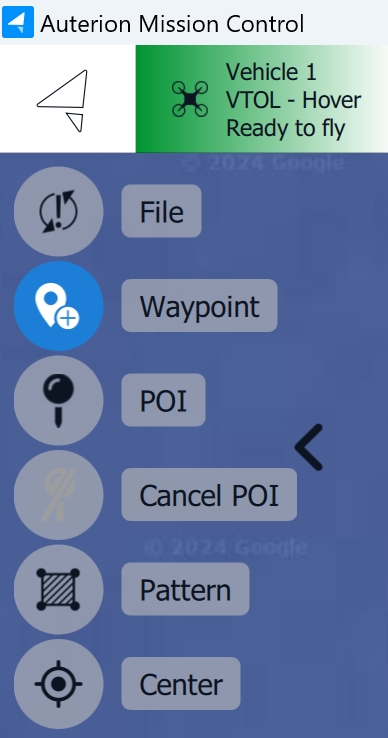
Click anywhere on the map to designate a location for the waypoint.
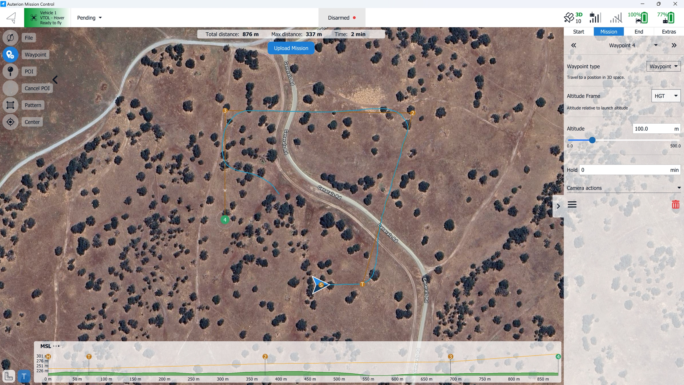
After placing the Waypoint on the map, the Mission tab in the Mission Editor on the right side of the screen will open.
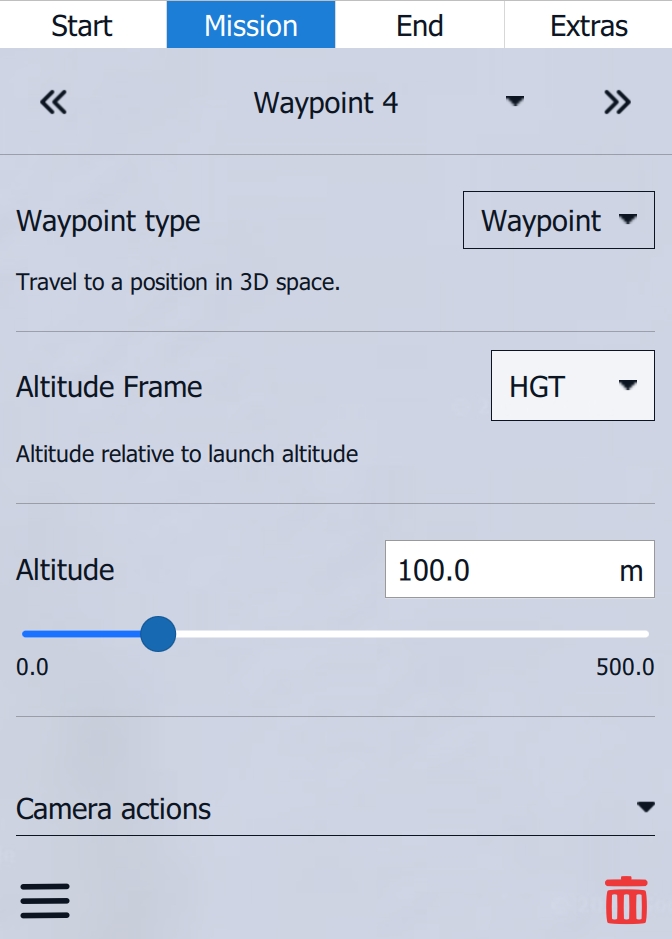
When clicking on the waypoint number, the Waypoint Summary opens, where all planned waypoints, survey and corridor items, and custom actions are available. Click on any of them to jump to the selected item.
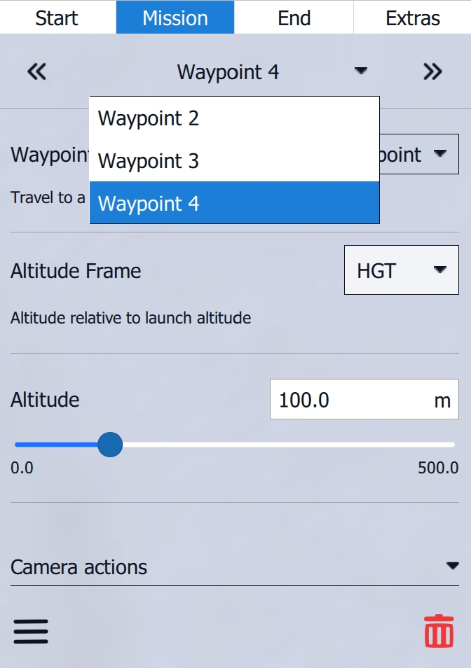
Waypoint type changes the waypoint command. The following Waypoint Commands are available in AMC's Normal Mode.
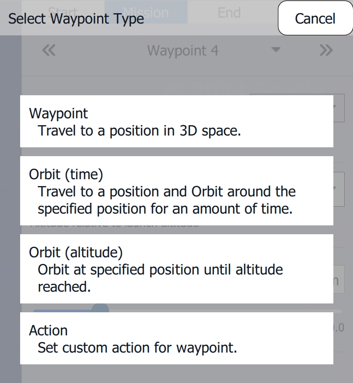
Waypoint
The vehicle will fly to the User-specified Location and Altitude, and once there, continue on to the next mission item. If there is no mission item after the waypoint, the vehicle will orbit in place at the waypoint’s location.
Orbit (time)
The vehicle will travel to the User-defined Orbit Location and Altitude. Once it arrives, the vehicle will Orbit the area until the specified orbit time expires, then it will proceed to the next mission item.
If the altitude of an Orbit (time) or Waypoint mission item is different from the vehicle’s current altitude, the vehicle will fly directly to the mission item in a straight line. It will not first ascend or descend to match the mission item’s altitude before proceeding forward.
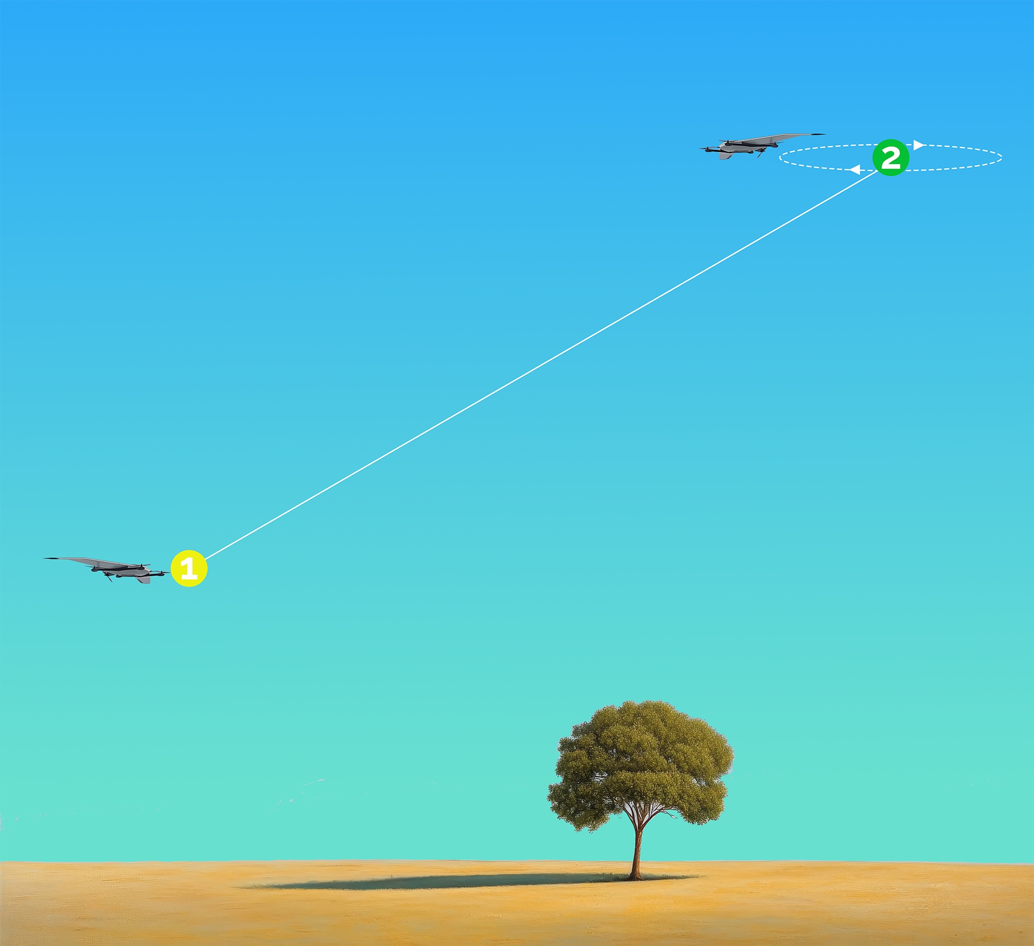
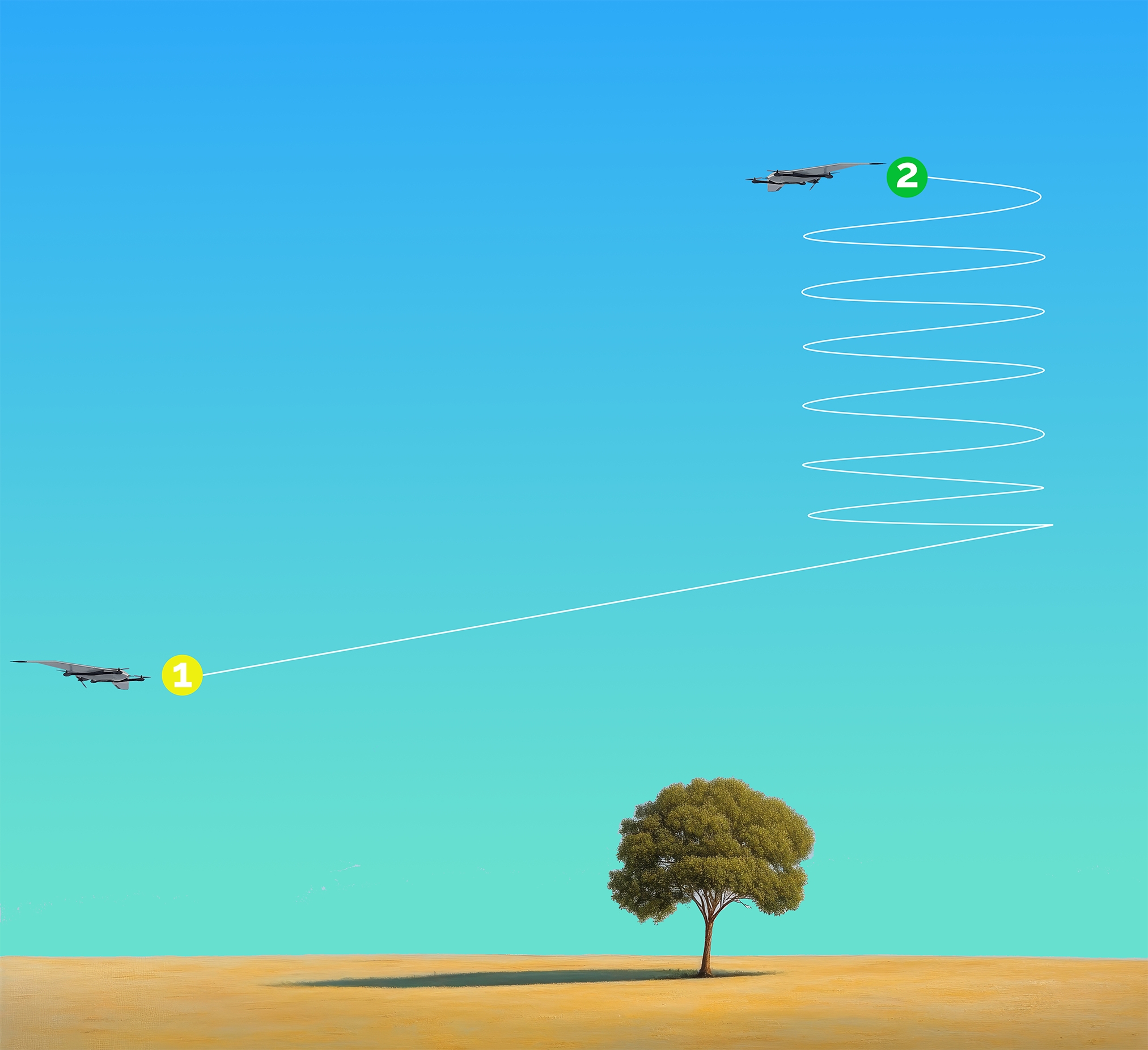
If the vehicle’s climb or descent rate isn’t sufficient to reach the destination mission item on a direct path, it will orbit at the mission item’s horizontal position until it completes the climb or descent to the required altitude.
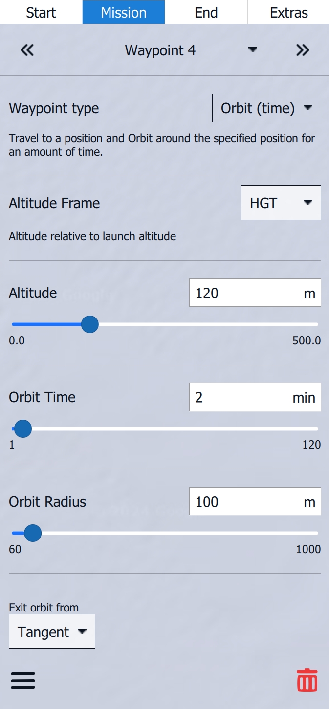
Orbit Time defines the duration of the Orbit Command, while Orbit Radius determines the size of the Orbit. Exit orbit from provides two choices for where within the Orbit the vehicle will exit.
Orbit (altitude)
The vehicle will fly to the Orbit (altitude) point at its current mission altitude. Only after reaching the horizontal location of the Orbit (altitude) will the vehicle begin climbing or descending to the user-specified altitude. This behavior differs from that of the other mission items described above. When using Orbit (altitude), be especially cautious about terrain collisions.
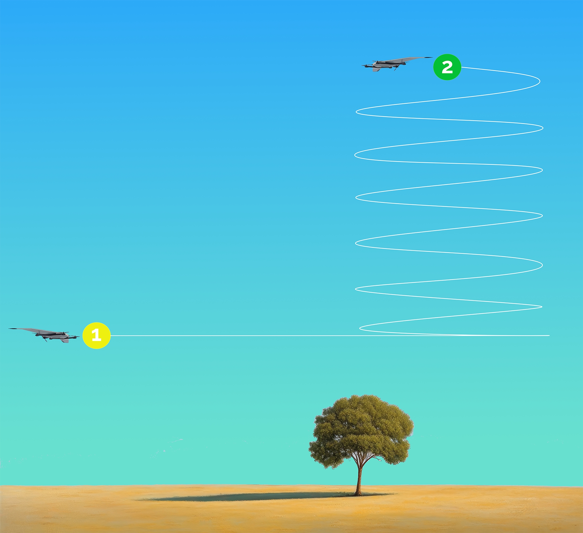
Orbit (altitude) is suitable for reaching a specific altitude before the flight path continues. This is necessary to avoid terrain collisions if the vehicle cannot achieve the required climb or descent rate directly on route.
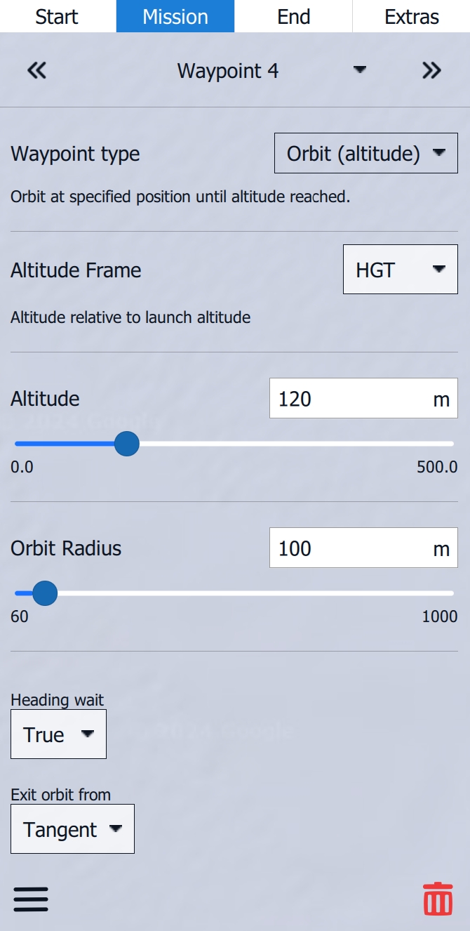
Altitude defines the final height of the Orbit Command, while Orbit Radius determines the size of the Orbit. Exit orbit from provides two choices for where within the Orbit the vehicle will exit.
Action
A waypoint that becomes a Custom Action attaches itself to the former Waypoint. This Custom Action can be used, for example, to enable or disable the Stealth Switch or to plan a Cargo Drop. The Stealth Switch and the Cargo Drop will be discussed in a later chapter in this manual.
The Altitude Frame is set to HGT by default. For standard operation, it is recommended to leave this setting as it is.
HGT
Height (Heights are referenced to the takeoff location)
MSL
Mean Sea Level (Altitude Above Mean Sea Leve)
AGL
Above Ground Level (Altitude Above Ground Level)
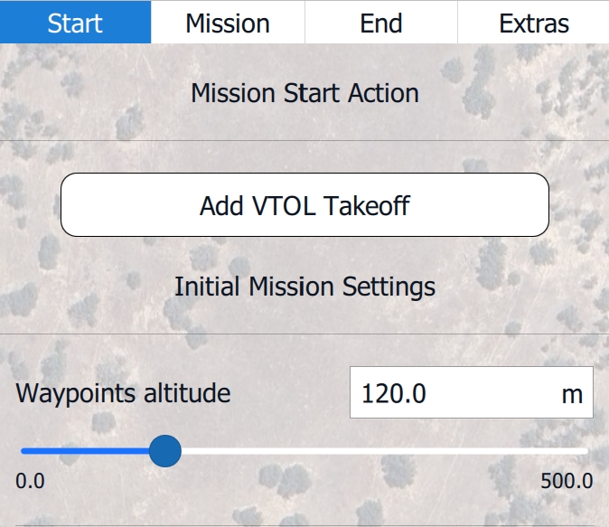
Set the Altitude of the Waypoint using the Altitude Slider or by typing in the desired value. The Default Waypoints altitude is set in the Mission Start Action and can be adjusted for each Waypoint individually. The following Waypoint automatically inherits the altitude of the previous Waypoint.

Always verify ground elevation using the Terrain Altitude Indicator. A ground collision is indicated when the orange line turns red in the Terrain Altitude Indicator and is also visible on the map.

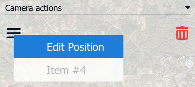
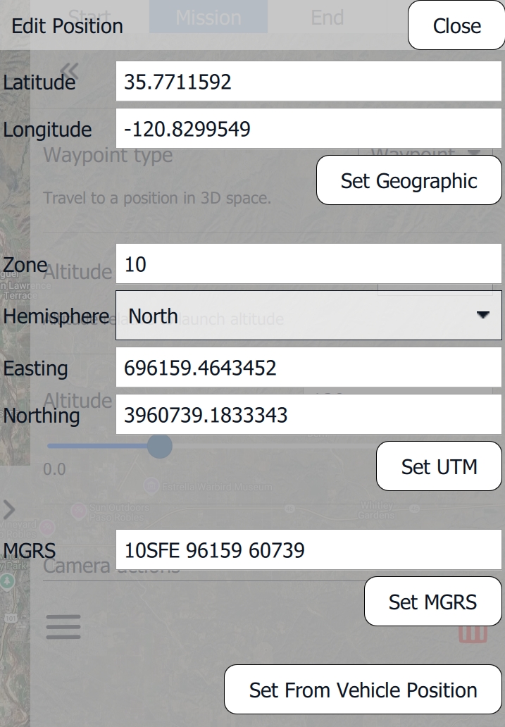
The Waypoint can be deleted by clicking the Red Trash Bin in the lower right corner of the Mission Editor window. By clicking the Three Dashes in the lower left corner of the Mission Editor window, Geographic Coordinates can be inserted for the Waypoint. Insert the values for the coordinate system of your choice and click Set to confirm the coordinates. Set From Vehicle Position will set the Waypoint to the current vehicle position.
Point of Interest (POI)
Select the POI Tool from the Plan Tools on the left side of the screen. Click on the map where you want to set the POI location. The camera gimbal will automatically point towards the most recently created POI.

In the Mission Editor, located on the right side of the screen, the POI menu displays the following settings.
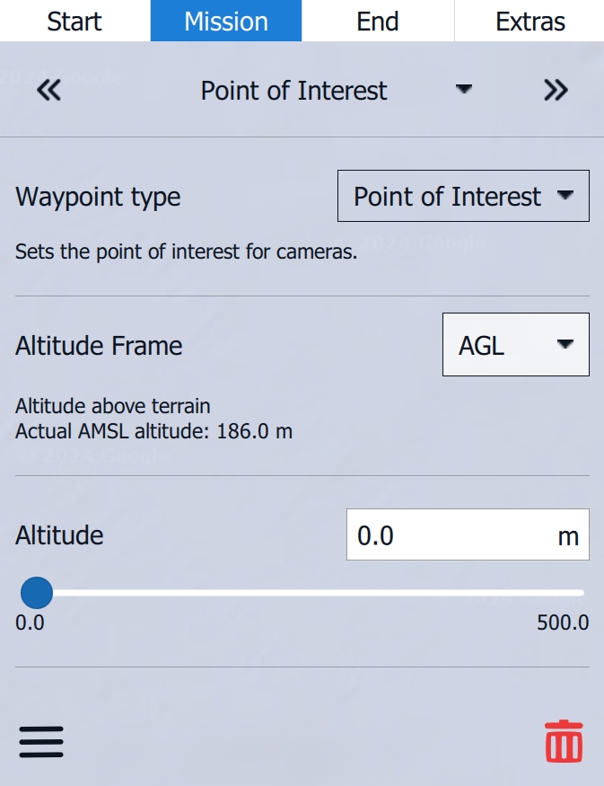
For the POI the Altitude Frame is set to AGL by default. It is recommended to leave this setting as it is.
HGT
Height (Heights are referenced to the takeoff location)
MSL
Mean Sea Level (Altitude Above Mean Sea Leve)
AGL
Above Ground Level (Altitude Above Ground Level)
The altitude of the POI can be set using the Altitude Slider. In most cases, it is recommended to leave this value at 0 m.
The POI can be deleted by clicking the Red Trash Bin in the lower right corner of the Mission Editor window. By clicking the Three Dashes in the lower left corner of the Mission Editor window, Geographic Coordinates can be inserted for the POI. Insert the values for the coordinate system of your choice and click Set to confirm the coordinates. Set From Vehicle Position will set the Waypoint to the current vehicle position.
To cancel the POI, select the Cancel POI tool from the Plan Tools.
