Mission End Action
This section explains how to properly plan a transition and VTOL landing.
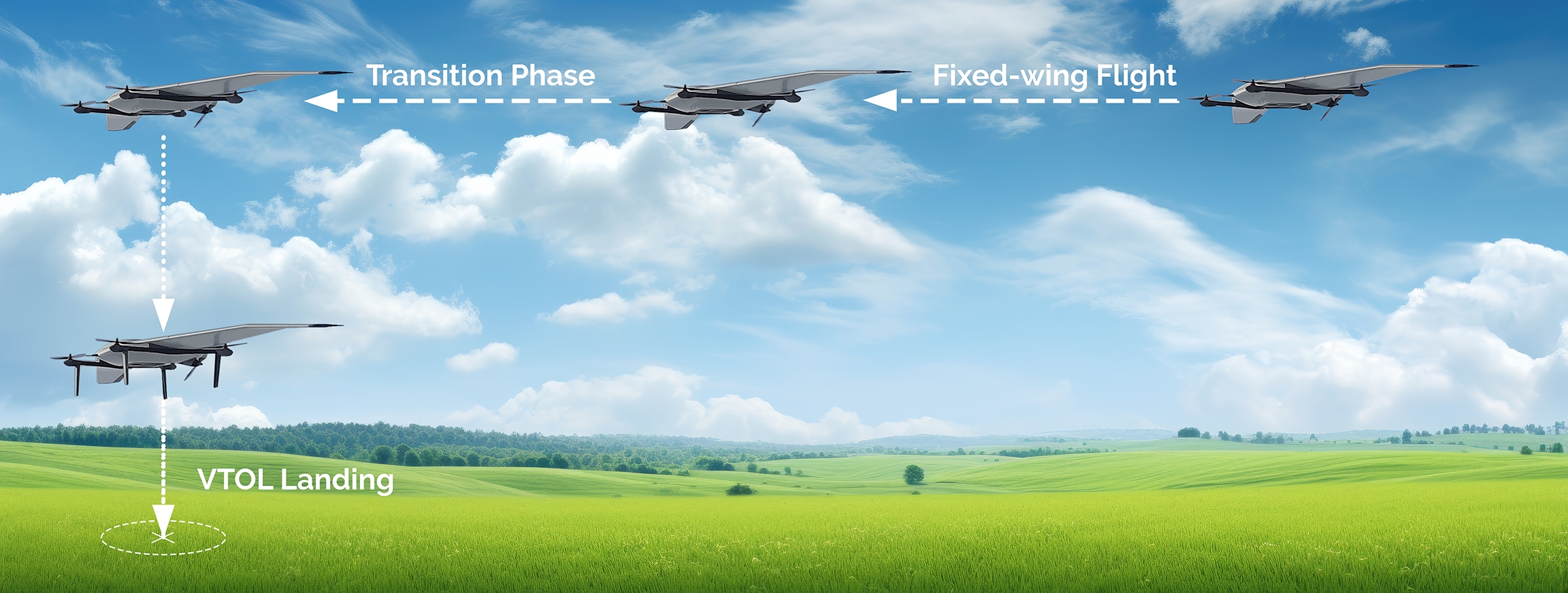
The DeltaQuad Evo is a VTOL UAV capable of Fixed-wing Flight (Aero Mode) and Vertical Takeoff and Landing (Hover Mode). Unlike traditional UAVs requiring a landing runway, the DeltaQuad Evo transitions seamlessly from Fixed-wing Mode to Multirotor Mode for VTOL landings. During this transition, the aircraft switches from using its forward thrust for horizontal flight to relying on its rotors for vertical lift, allowing it to hover and land precisely.
This capability offers several advantages:
No runway required: It can land in confined spaces, making it suitable for urban, mountainous, or remote areas.
Versatile operations: The vehicle can fly long distances in efficient Fixed-wing Mode and switch to Multirotor Mode for precise VTOL landings.
Reduced risk: VTOL landings reduce the risk of damage from hard landings or rough terrain.
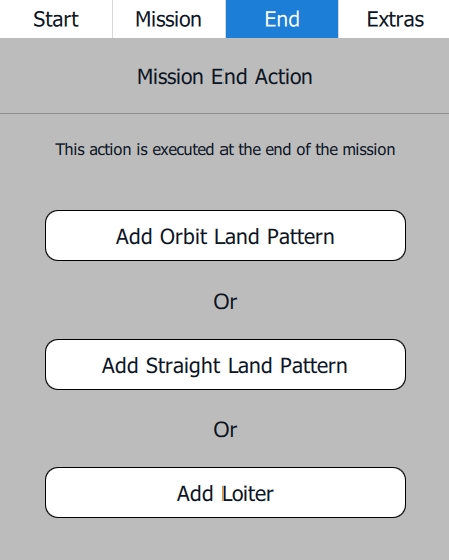
After all Intermediate Waypoints have been planned, click the End tab in the Mission Editor on the right side of the screen. Three options for the Mission End Action will be displayed.
By choosing either Add Orbit Land Pattern or Add Straight Land Pattern, the following two options will be available if the vehicle is connected to the AMC.
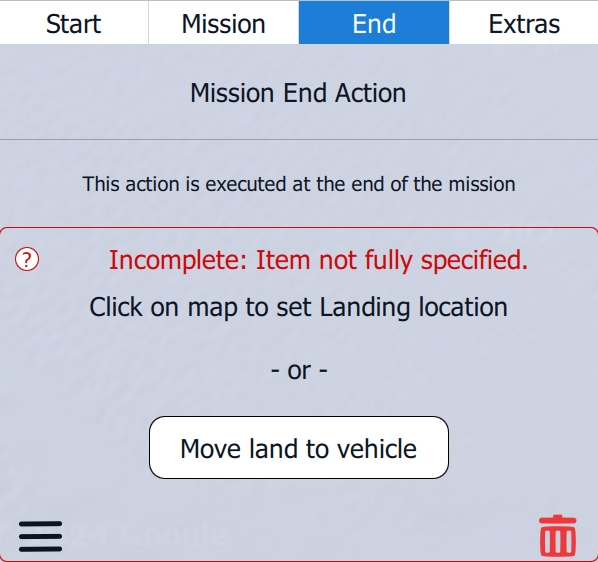
It is recommended to choose Move land to vehicle, as it will set the touchdown of the landing to the takeoff location. If the vehicle is not connected to AMC, choose Click on map to set landing location and set the landing location manually.
Orbit Land Pattern
When choosing Add Orbit Land Pattern, AMC automatically creates the Landing Pattern as shown on the map.
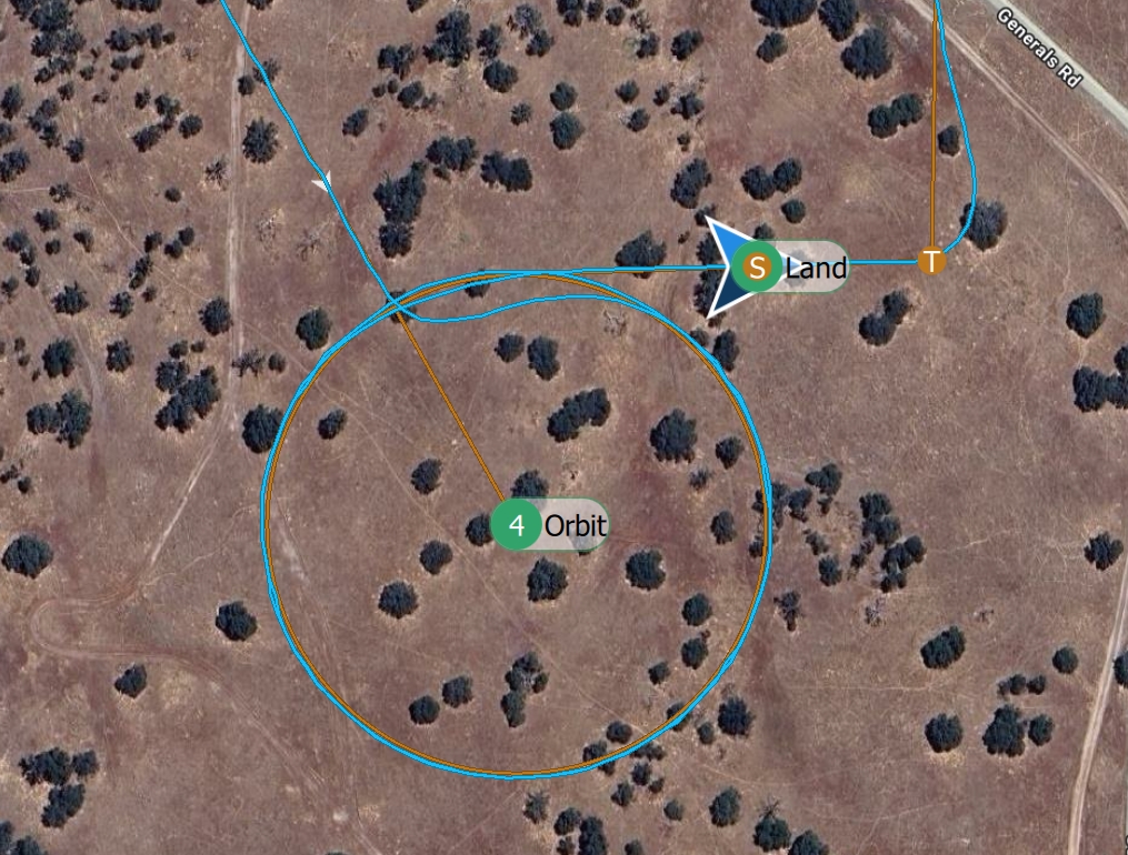
An Orbit Land Pattern involves the vehicle flying in an Orbit around a designated location while gradually descending to a set altitude. Once it reaches the predetermined altitude, the vehicle leaves the Orbit and heads toward the landing location, where it transitions from Fixed-wing Mode to Multirotor Mode, slowing down and hovering directly above the designated landing area. From there, it performs a vertical descent for a precise VTOL landing. This method allows for controlled, safe landings, especially in confined or challenging environments.
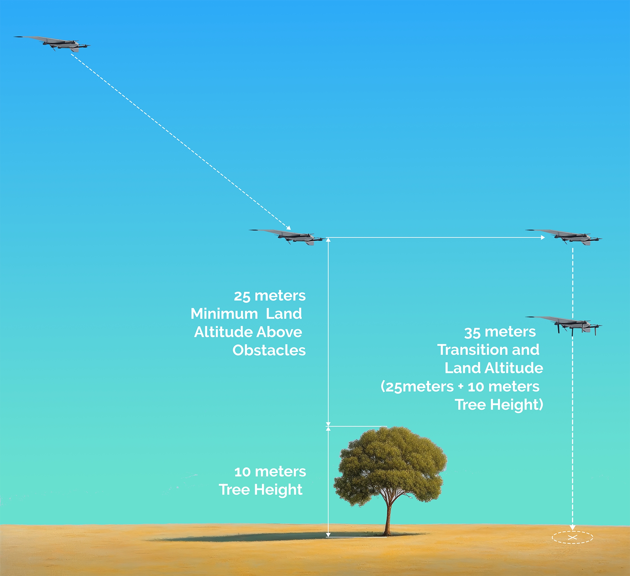
The minimum Landing Altitude the vehicle descends to needs to be set at least 25 meters above the highest obstacles in the landing area. For example, if the average tree height in the landing area is 10 meters, the Landing Altitude must be set to at least 35 meters.
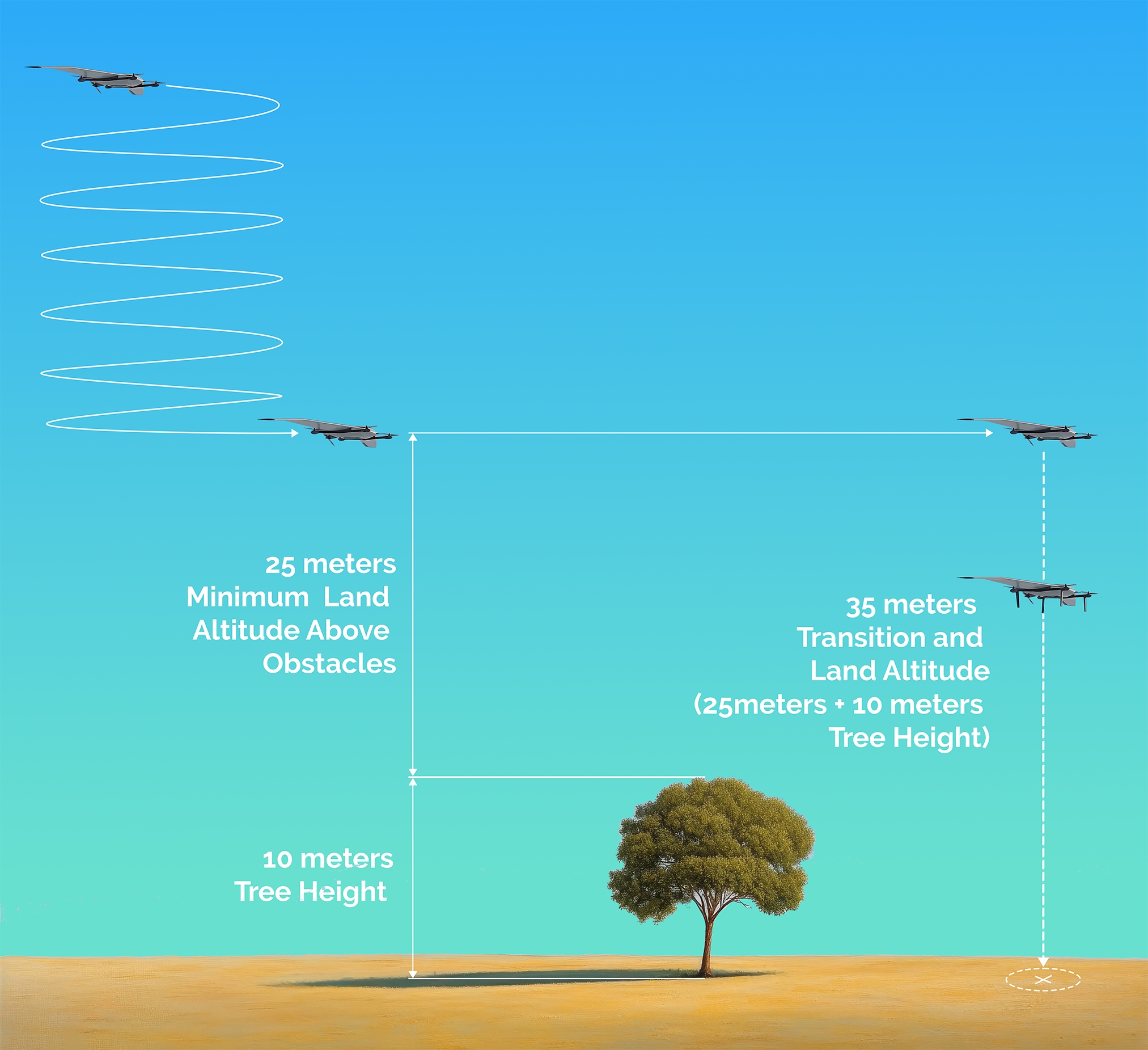
At every stage in the fixed-wing portion of the flight, a vertical separation of at least 25 meters above the highest obstacle must be maintained.
When choosing Add Orbit Land Pattern, the following window appears on the right side of the screen, providing options for the Orbit of the Landing Pattern.
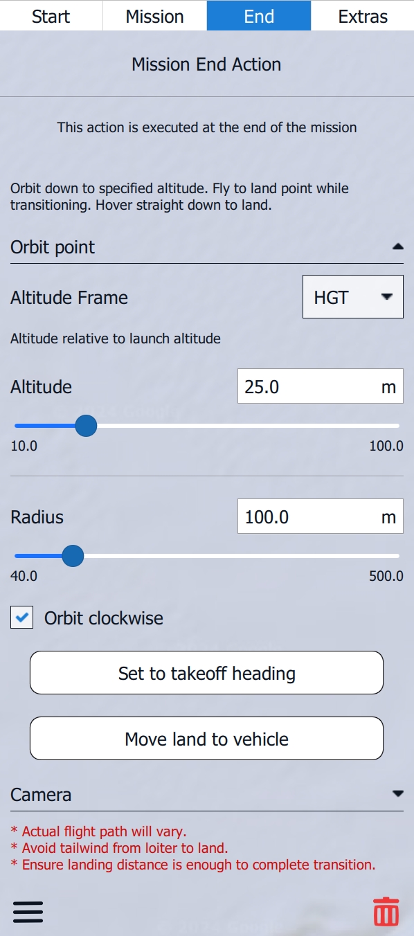
The Altitude Frame is set to HGT by default. For standard operation, it is recommended to leave this setting as it is.
Altitude Frame Options
HGT
Height (Heights are referenced to the takeoff location)
MSL
Mean Sea Level (Altitude Above Mean Sea Leve)
AGL
Above Ground Level (Altitude Above Ground Level)
Set the Altitude (Land Altitude) to at least 25 meters above any obstacle in the landing area.
It is recommended to leave the Radius at 100 meters. 75 meters is possible in calm winds.
The indicated Orbit in the case of a loiter down is only an estimate. The DeltaQuad Evo may drift outside this Orbit by up to 100 meters based on wind conditions and the vehicle's position. Therefore, thoroughly inspect the entire landing area and its surroundings.
The Orbit Direction will be clockwise by default. This option can be disabled, allowing the Orbit position to be set to the north, which enables a counter-clockwise Orbit Direction.
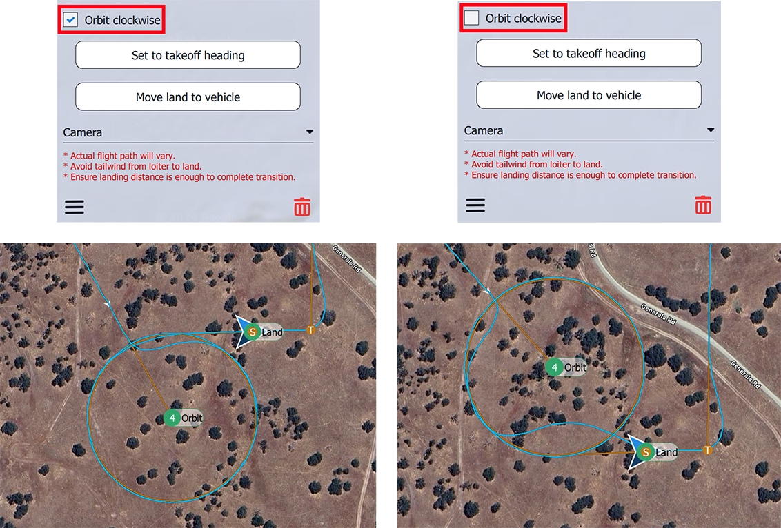
The direction of the Landing Pattern will be automatically set to match the Takeoff and Transition Direction, assuming that the Transition Direction was planned so that the vehicle can perform the Takeoff and Transition into the wind. The Orbit and, therefore, the Landing Direction can be repositioned if a crosswind landing is necessary. This procedure should only be performed in wind conditions below 5 m/s. The Set to takeoff heading button can be used to realign the landing direction to the vehicle's heading.
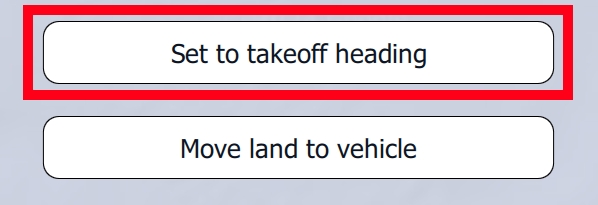
The Move land to vehicle option sets the Landing Location to the vehicle’s position when the vehicle is connected to AMC. This can be convenient if the mission was initially planned without the vehicle being connected.
The Mission End Action can be deleted by clicking the Red Ttrash Bin in the lower right corner of the Mission Editor window. By clicking the Three Dashes in the lower left corner of the Mission Editor window, the option Move to vehicle position appears. This option is the same as Move land to vehicle.

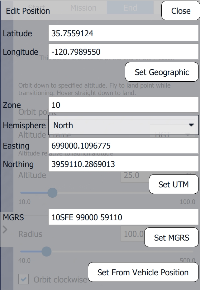
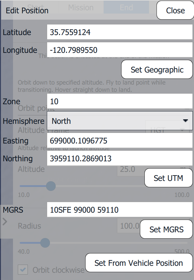
When choosing Edit Land Position, a window will open where geographic coordinates can be inserted for the Landing Location. Insert the values for the coordinate system of your choice and click Set to confirm the coordinates. Set From Vehicle Position will set the Landing Location to the current vehicle position.
Straight Land Pattern
When choosing Add Straight Land Pattern, AMC automatically creates the Landing Pattern as shown on the map.
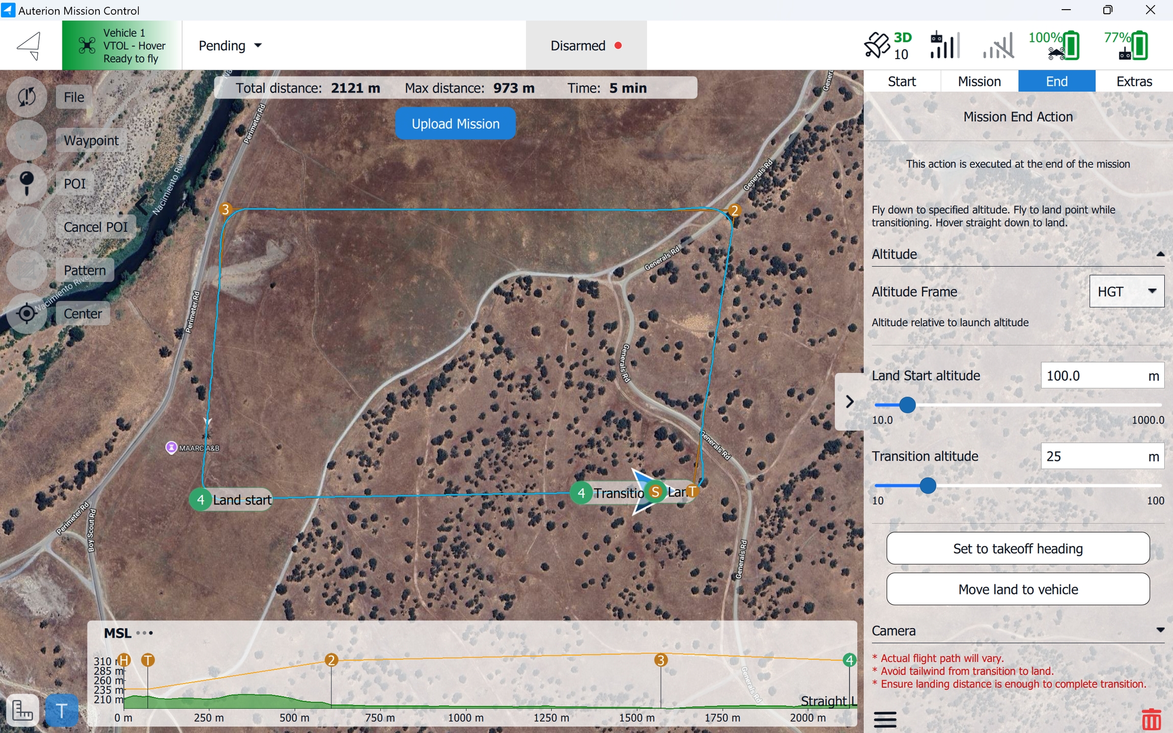
A Straight Land Pattern involves the vehicle descending from a set Land Start altitude to the Transition altitude in a straight line. Once it reaches the predetermined Transition altitude, the vehicle heads toward the landing location, where it transitions from Fixed-wing Mode to Multirotor Mode, slowing down and hovering directly above the designated landing area. From there, it performs a vertical descent for a precise VTOL landing. This method allows for controlled, safe landings, especially in confined or challenging environments.
The minimum Transition altitude or Landing Altitude the vehicle descends to needs to be set at least 25 meters above any obstacles in the landing area. For example, if the average tree height in the landing area is 10 meters, the Landing Altitude must be set to at least 35 meters.
When choosing Add Straight Land Pattern, the following window appears on the right side of the screen, providing the following Settings.
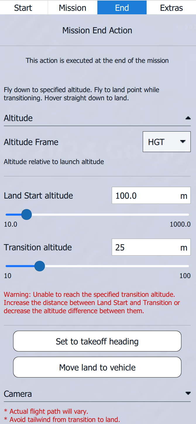
The Altitude Frame is set to HGT by default. For standard operation, it is recommended to leave this setting as it is.
Altitude Frame Options
HGT
Height (Heights are referenced to the takeoff location)
MSL
Mean Sea Level (Altitude Above Mean Sea Leve)
AGL
Above Ground Level (Altitude Above Ground Level)
Set the Land Start altitude. This is the altitude the vehicle starts its descent to the set Transition altitude.
Set the Transition altitude to at least 25 meters above any obstacle in the landing area.
The direction of the Straight Land Pattern will be automatically set to match the Takeoff and Transition Direction, assuming that the Transition Direction was planned so that the vehicle can perform the Takeoff and Transition into the wind. The Straight Land Pattern can be repositioned if a crosswind landing is necessary. This procedure should only be performed in wind conditions below 5 m/s. The Set to takeoff heading button can be used to realign the landing direction to the vehicle's heading.

The Move land to vehicle option sets the Landing Location to the vehicle’s position when the vehicle is connected to AMC. This can be convenient if the mission was initially planned without the vehicle being connected.

The Mission End Action can be deleted by clicking the Red Trash Bin in the lower right corner of the Mission Editor window. By clicking the Three Dashes in the lower left corner of the Mission Editor window, the option Move to vehicle position appears. This option is the same as Move land to vehicle.

When choosing Edit Land Position, a window will open where geographic coordinates can be inserted for the Landing Location. Insert the values for the coordinate system of your choice and click Set to confirm the coordinates. Set From Vehicle Position will set the Landing Location to the current vehicle position.
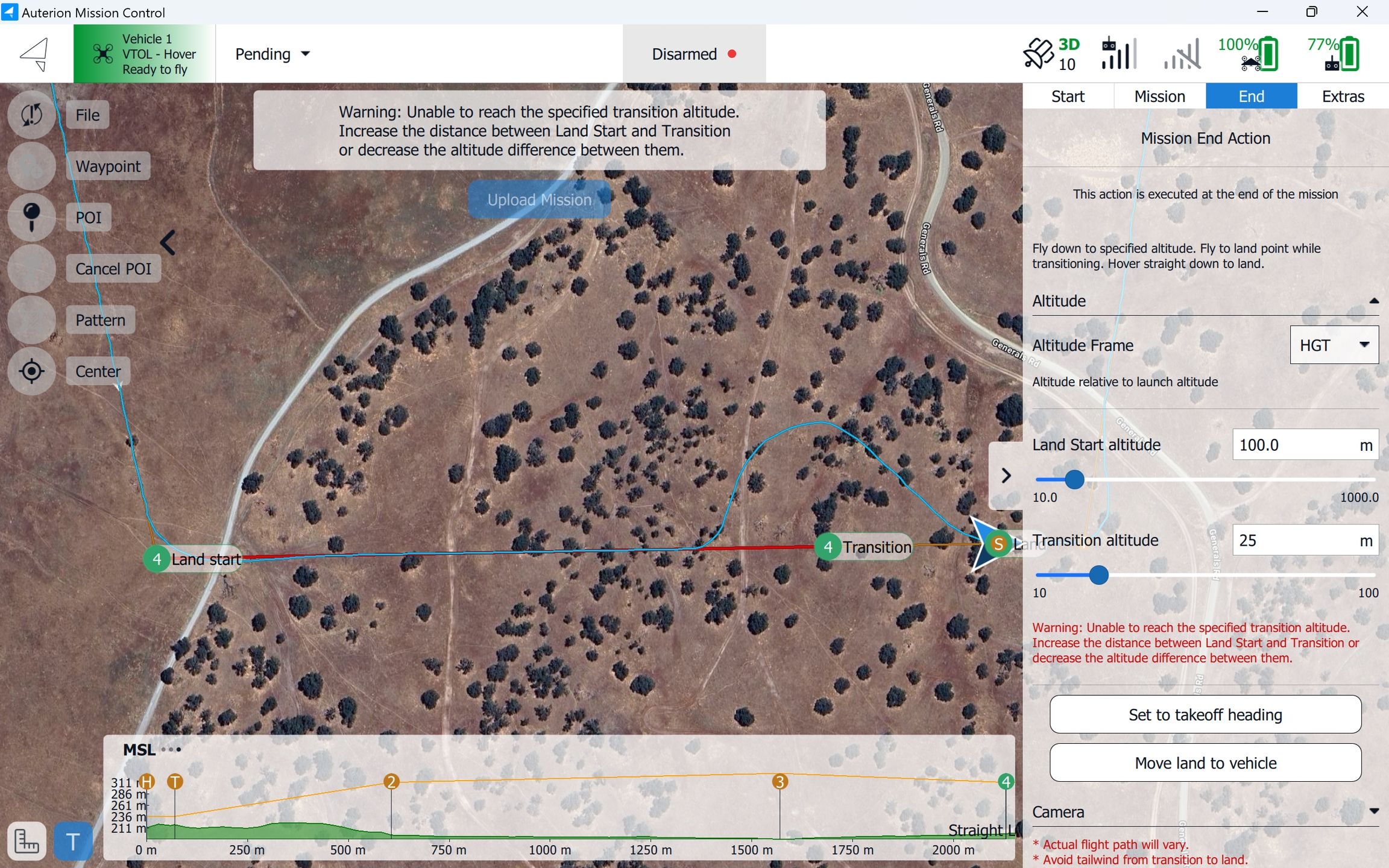
The Land start item can be dragged in every direction. If the Land start item is too close to the Transition item where the vehicle is not able to reach the set Transition altitude, a warning will appear on the upper screen, and the orange flight path will turn red. To solve this, lower the Land Start altitude or drag the Land start item further away from the Transition item.
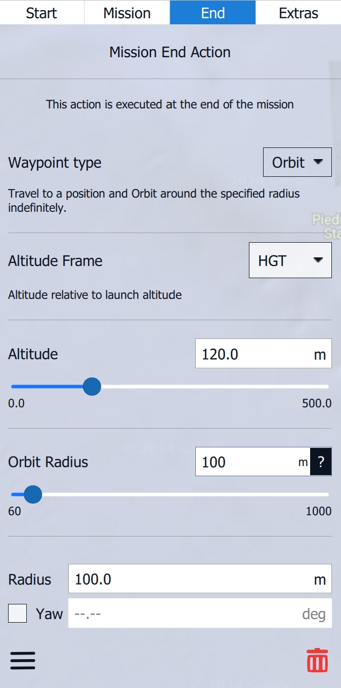
Add Loiter
The Mission End Action can be set to a Loiter. This is useful when using the Quick Takeoff functionality, where a mission plan is created and uploaded to the vehicle after takeoff. These mission plans do not use a traditional Takeoff and Transition item, as the Quick Takeoff is used. After the mission plan has been executed, the vehicle will loiter at the planned Orbit location, awaiting the next commands. For more details about the Quick Takeoff, please read here.
Mission Upload
After the mission plan has been created, make sure to verify the ground elevation. The Terrain Altitude Indicator displays the mission height (orange top line) and the ground elevation (green ground profile).

A ground collision is indicated in the Terrain Altitude Indicator by the orange line turning red. On the map, the orange flight path will turn yellow. For more information about the Terrain Altitude Indicator, please revisit the dedicated section here.
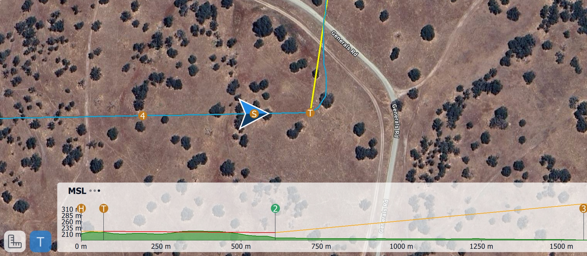
It is recommended to double-check the terrain altitudes in Google Earth. For more information, please revisit the Best Practices and Tips section here.
After the mission has been planned and all necessary items thoroughly checked, the mission plan can be uploaded to the vehicle by clicking on the Upload Mission button.
