> For the complete documentation index, see [llms.txt](https://docs.deltaquad.com/sth/llms.txt). Markdown versions of documentation pages are available by appending `.md` to page URLs; this page is available as [Markdown](https://docs.deltaquad.com/sth/flight/planning-a-mission/set-intermediate-waypoints.md).

# Set intermediate waypoints

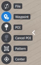
1. To plan mission items such as regular waypoints select the Waypoint Tool <img src="/files/unf8DBwz8dYwIpj3tehC" alt="" data-size="line"> from the Plan Tools on the left side of the screen.
<figure><img src="/files/ngQcvyoUCbT0WzlaP1dQ" alt=""><figcaption></figcaption></figure>

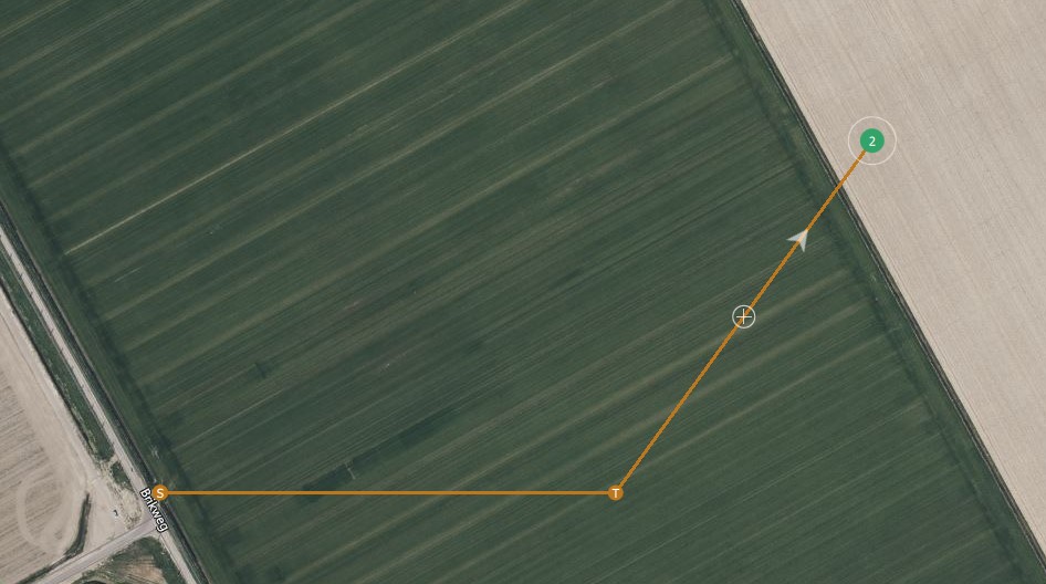
2. Click anywhere on the map to designate a location for the waypoint.

<figure><img src="/files/po6GaYdZVSFQISwsZ5Te" alt="" width="563"><figcaption></figcaption></figure>

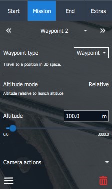
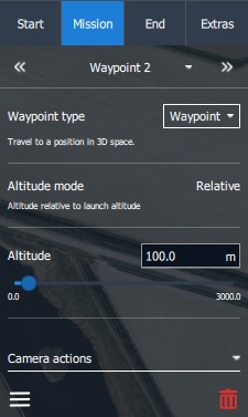
3. After placing the waypoint on the map, the Mission tab in the Plan Item Selector on the right side of the screen will open.

<figure><img src="/files/5mji8lpPaa0tNqHBMvuN" alt=""><figcaption></figcaption></figure>

## Plan View mission items

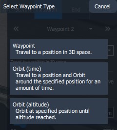
4. Choose and set up the desired mission item from the Waypoint type tab.&#x20;

<figure><img src="/files/RzaB7m5dLit5zpiJCxmz" alt=""><figcaption></figcaption></figure>

When AMC is used in [Normal Mode](/sth/flight/ground-control-station-overview.md#normal-and-advanced-mode) three options are available.

<figure><img src="/files/cW2haGIev96YFPftkILV" alt=""><figcaption></figcaption></figure>

### Waypoint type - Waypoint

<table><thead><tr><th width="288">Waypoint type</th><th>Action</th></tr></thead><tbody><tr><td><img src="/files/3JOUnrTdthednaup4Ywj" alt=""></td><td>The vehicle flies toward the location and altitude specified by the user. Once it arrives, it will proceed to the next mission item. If there are no further mission items following the Waypoint, the vehicle will orbit at the Waypoint's location.</td></tr></tbody></table>

<figure><img src="/files/ScXXq1YW6fJKlYE9vjQL" alt=""><figcaption></figcaption></figure>

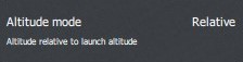
The Altitude mode is the altitude above the launch elevation.

<figure><img src="/files/ulPmNyKapnXANJWxLvHd" alt=""><figcaption></figcaption></figure>

Set the altitude for the waypoint with the altitude slider.

<figure><img src="/files/ZadgFPJjWtph6qWlWkoO" alt=""><figcaption></figcaption></figure>

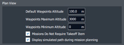
The default range can be changed in the Application Settings. Settings>General>Plan View>Waypoints Maximum Altitude

<figure><img src="/files/ipLuvpdbksX91qNzncYe" alt=""><figcaption></figcaption></figure>

{% hint style="info" %}
When changing the altitude of a waypoint, the next waypoint's altitude is automatically set to that value.
{% endhint %}

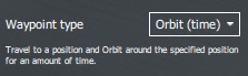
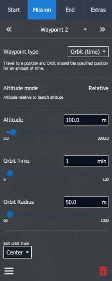
### Waypoint type - Orbit (time)

<table><thead><tr><th width="286">Waypoint type</th><th>Action</th></tr></thead><tbody><tr><td><img src="/files/iihTIf2kQ1eugAfibyUX" alt=""></td><td>The vehicle flies toward the location and altitude specified by the user. Once it arrives, the vehicle will initiate an orbit and continue to circle that position. When the specified Orbit Time elapses, it will proceed to the next mission item.</td></tr></tbody></table>

<figure><img src="/files/SXbCPyY17kK9CjWMa4fs" alt=""><figcaption></figcaption></figure>

The Altitude mode is the altitude above the launch elevation.

<figure><img src="/files/ulPmNyKapnXANJWxLvHd" alt=""><figcaption></figcaption></figure>

Set the altitude for the waypoint with the altitude slider.

<figure><img src="/files/ZadgFPJjWtph6qWlWkoO" alt=""><figcaption></figcaption></figure>

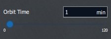
Set the duration of how long the DeltaQuad EVO should orbit at the designated location.

<figure><img src="/files/8okX0vNPNgv3D3lP1TmD" alt=""><figcaption></figcaption></figure>

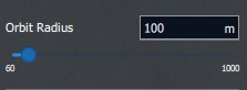
Set the radius of the Orbit. We recommend a minimum radius of 100m. 75m is possible in calm winds.

<figure><img src="/files/MjDKmRluRCkhpozs2Ls8" alt=""><figcaption></figcaption></figure>

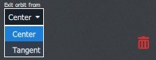
Choose the vehicle's exit point from the Orbit.

<figure><img src="/files/lPEWLNySGElhoFEXlUYr" alt=""><figcaption></figcaption></figure>

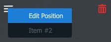
At the bottom of the Mission tab, you can edit the position of the mission item, or delete it.

<figure><img src="/files/kPIbnO6G93PxPoYzCNsa" alt=""><figcaption></figcaption></figure>

{% hint style="info" %}
If the vehicle's altitude differs from the altitude of the next mission item, the vehicle will fly in a straight line toward that mission item.&#x20;

The vehicle will **not** ascend or descend immediately to the altitude of the next mission item before reaching it.
{% endhint %}

{% hint style="info" %}
If the vehicle can't reach the altitude of the next mission item due to an insufficient climb or descent rate, the vehicle will orbit at the location of the mission item to finish climbing or descending to the item's altitude.
{% endhint %}

### Waypoint type - Orbit (altitude)

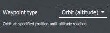
<table><thead><tr><th width="295">Waypoint type</th><th>Action</th></tr></thead><tbody><tr><td><img src="/files/eUgmzi6ztMSBwuqigFz1" alt=""></td><td>The vehicle flies toward the location at its current altitude. Once it arrives, the vehicle will initiate an orbit and start climbing or descending to the user-specified altitude. When the altitude is reached, the vehicle will continue to the next mission item.</td></tr></tbody></table>

<figure><img src="/files/C9aBAzYY3i79XQgwhB3I" alt=""><figcaption></figcaption></figure>

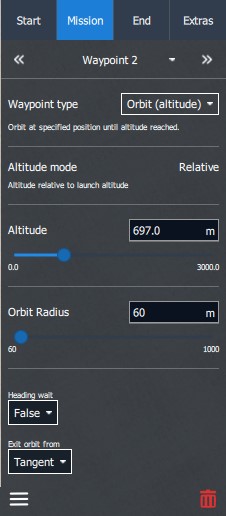
The Altitude mode is the altitude above the launch elevation.

<figure><img src="/files/ulPmNyKapnXANJWxLvHd" alt=""><figcaption></figcaption></figure>

Set the altitude for the waypoint with the altitude slider.

<figure><img src="/files/ZadgFPJjWtph6qWlWkoO" alt=""><figcaption></figcaption></figure>

Set the radius of the Orbit. We recommend a minimum radius of 100m. 75m is possible in calm winds.

<figure><img src="/files/MjDKmRluRCkhpozs2Ls8" alt=""><figcaption></figcaption></figure>

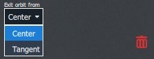
Choose the vehicle's exit point from the Orbit.

<figure><img src="/files/EBH4TN5SFbQDylcuSih8" alt=""><figcaption></figcaption></figure>

At the bottom of the Mission tab, you can edit the position of the mission item, or delete it.

<figure><img src="/files/kPIbnO6G93PxPoYzCNsa" alt=""><figcaption></figcaption></figure>

{% hint style="info" %}
When using Orbit (altitude), the operator must be especially cautious about terrain collisions.
{% endhint %}

{% hint style="info" %}
Orbit (altitude) is practical for reaching a desired altitude before the flight path continues or when the vehicle's climb or descent rate will not be sufficient to reach the required altitude *en route*.
{% endhint %}


---

# Agent Instructions
This documentation is published with GitBook. GitBook is the documentation platform designed so that both humans and AI agents can read, navigate, and reason over technical content effectively. Learn more at gitbook.com.

## Querying This Documentation
If you need additional information that is not directly available in this page, you can query the documentation dynamically by asking a question.

Perform an HTTP GET request on the current page URL with the `ask` query parameter, and the optional `goal` query parameter:

```
GET https://docs.deltaquad.com/sth/flight/planning-a-mission/set-intermediate-waypoints.md?ask=<question>&goal=<endgoal>
```

`ask` is the immediate question: it should be specific, self-contained, and written in natural language.
`goal` is optional and describes the broader end goal you are ultimately trying to accomplish on behalf of the user. GitBook uses it to tailor the answer towards what is most useful for that goal.

The response will contain a direct answer to the question and relevant excerpts and sources from the documentation.

Use this mechanism when the answer is not explicitly present in the current page, you need clarification or additional context, or you want to retrieve related documentation sections.